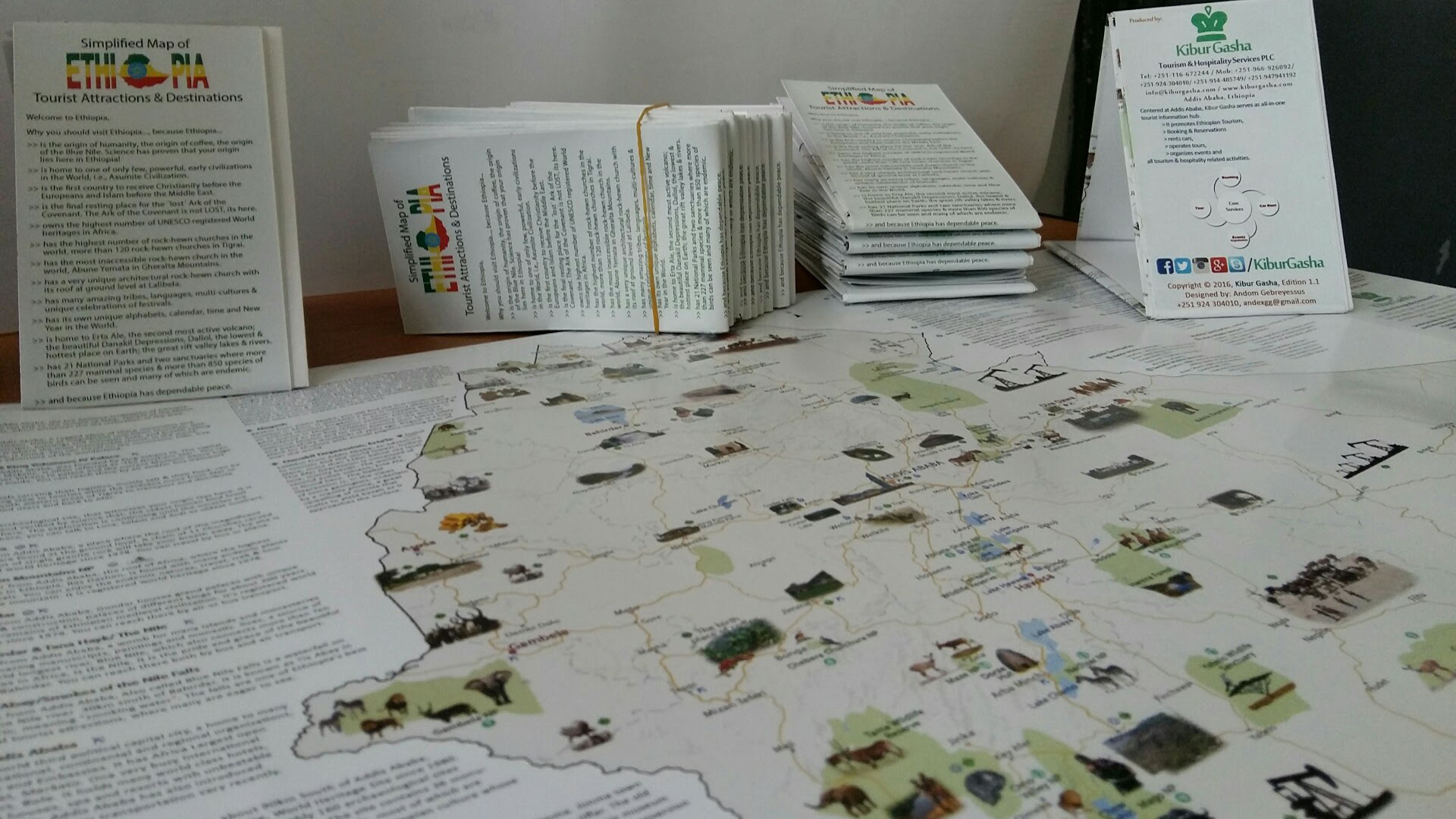
This is a comprehensive tourist map of Ethiopia — a high-quality, colorful, and pictorially illustrated map with concise descriptions. It highlights all major tourist attractions as well as potential investment areas across the country.
Some of the basic information presented in the map includes:

- General information about ‘Why Visit Ethiopia?’
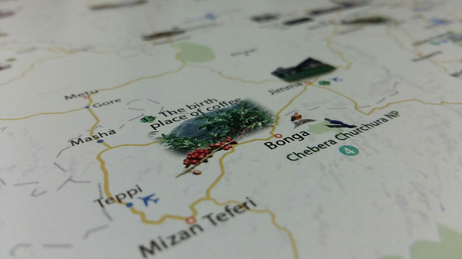
- Ethiopia – The Land of Origins (The origin of human kind, the Blue Nile, Coffee, etc)
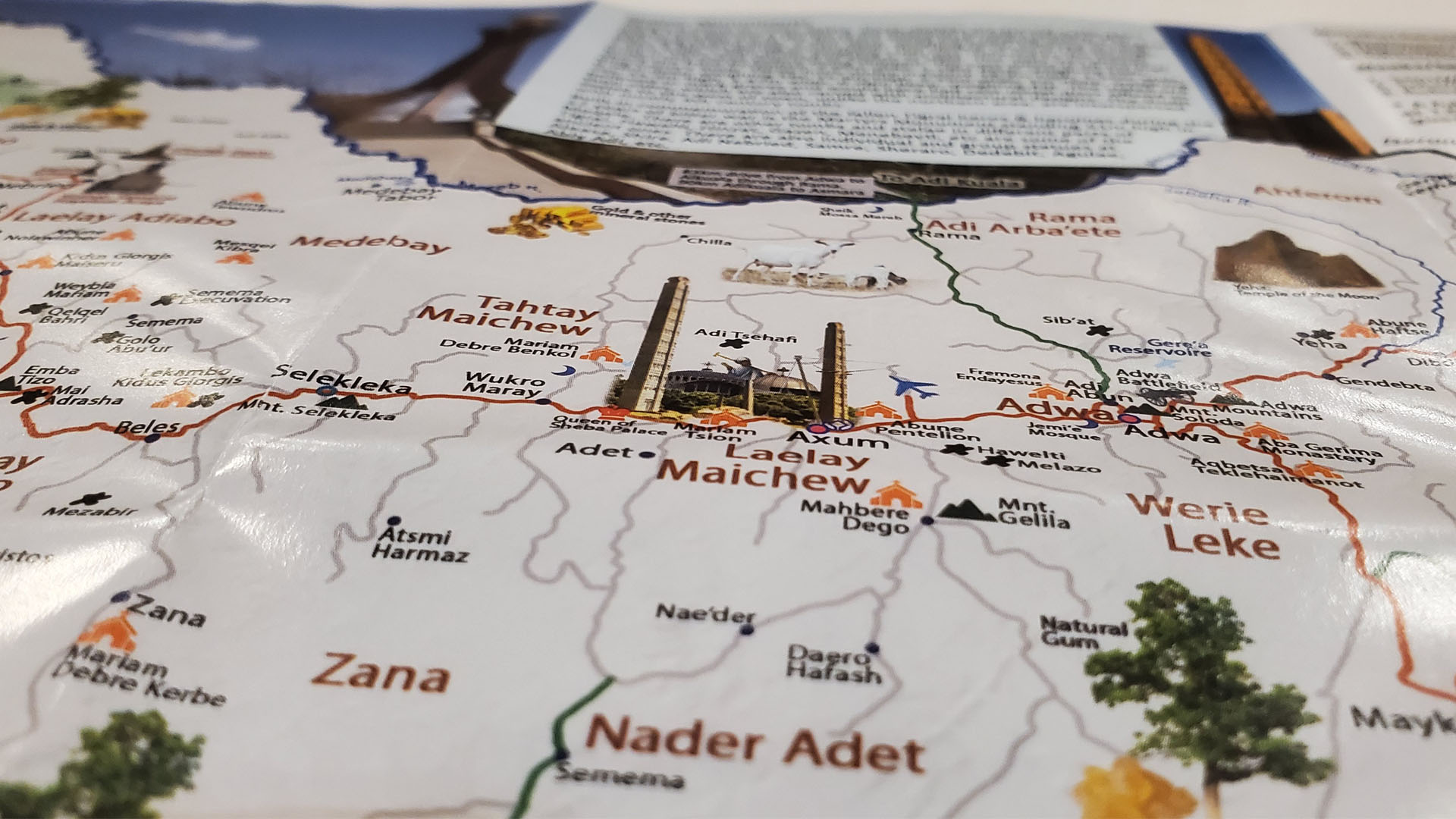
- Ethiopia’s World Heritage sites (10 tangible and 2 intangible: Axum, Gondar, Lalibela, Lucy, Harar, Tiya, Konso, Meskel etc)
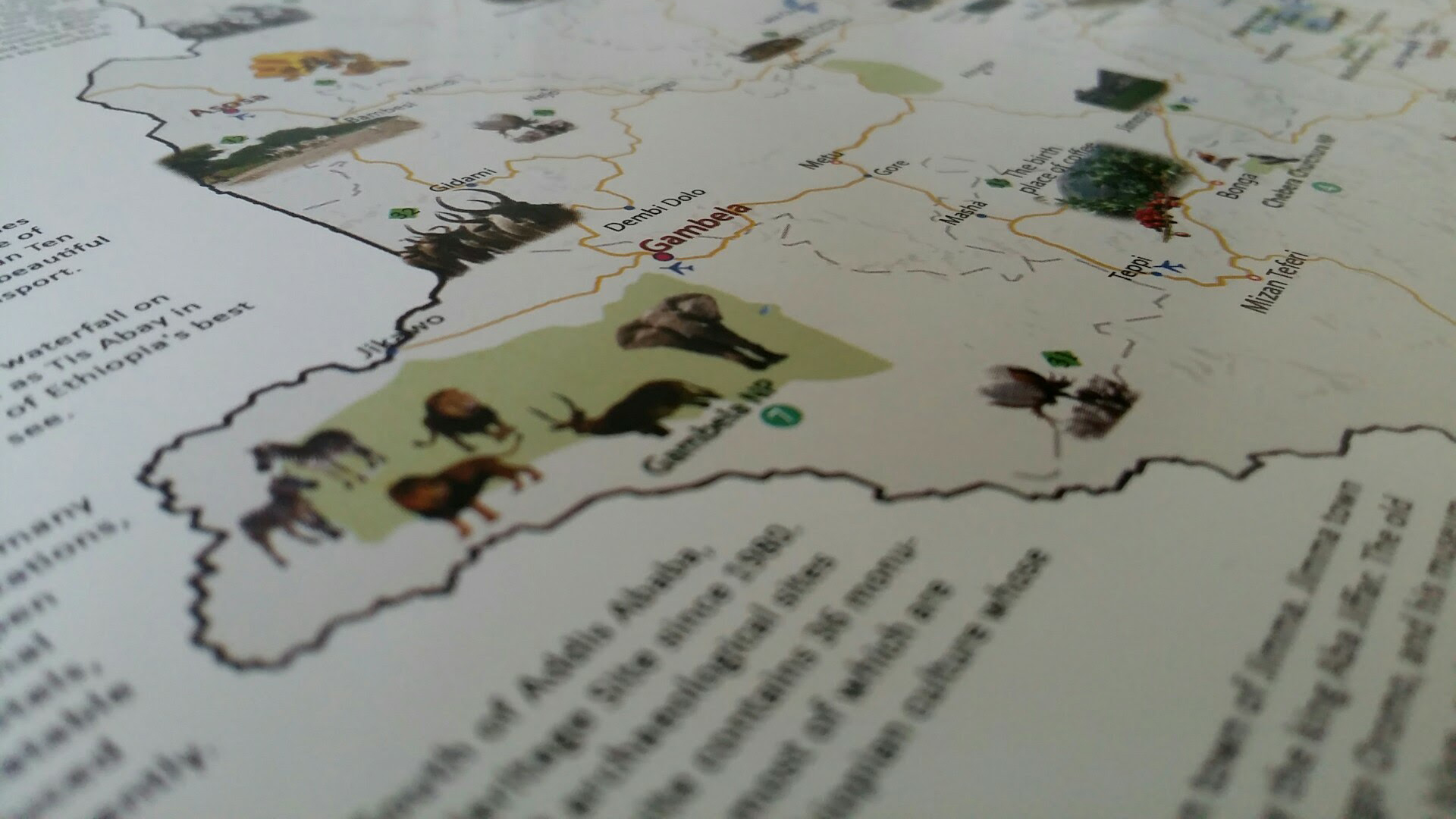
- Other popular attractions and destinations (Gheralta, Erta Ale, Blue Nile, etc)
- National Parks, Sanctuaries, Forest Reserves and wildlife reserves
- Less promoted areas (such as King Kumsa Moroda Palace of Nekemt, Ras Hailu Palace of Debre Markos, Sheik Hussein Dirre Mosque, etc)
- Capital city, Regional Capital cities and other cities
- Investment/treasure areas (gold, oil, cotton, ranch, lentils, coffee, etc)
- Mountains, rivers and lakes
- Places of special interest (lowest point, highest point, cold, hot, etc)
- Transportation modes, distances between places, etc.
- Events, Festivals and Celebrations.
- Unique alphabets and numbers, etc.
The map is intended to guide tourists throughout the country, used as a teaching-learning material for classroom instructions, investment guide, personal references, for kids and grownups, framed wall posts, gifts, etc.
It’s handy, neat, and high quality.